National Preparedness Month couldn’t be more relevant

September 12, 2018

Forecasters predict that Hurricane Florence will aim its “potential for unbelievable damage” at the Carolinas and Virginia and will not have a significant impact on the New York area.

Beware! It’s peak hurricane season and this is not a time for complacency. We may see fewer hurricanes this year, but scientists conclude that hurricanes are getting wetter and slower.

FEMA: 2018 Hurricane Season Outlook

May 02, 2018
Photo: NOAA.gov

Arago’s Admonition:

“Never, no matter what may be the progress of science, will honest scientific men who have regard for their reputations venture to predict the weather.”

It is hard to believe, as FEMA and our stakeholders are still very much in active recovery mode from the 2017 hurricane season, that the official start to the 2018 Atlantic Hurricane Season begins on June 1st.  Forecasts from leading researchers and meteorologists, including those at Colorado State University, are predicting a busy 2018 hurricane season with a 60% probability for a major hurricane hitting the U.S. coast. Researchers also predict a slightly above average season in terms of number of hurricanes formed and intensity of the storms.

According to the National Oceanic and Atmospheric Administration (NOAA), an above average hurricane season would equal over 11 named storms. NOAA continues to monitor weather patterns and will make formal forecasts closer to the start of June when the season officially begins.

Colorado State University added that higher than average ocean waters in the western tropical Atlantic combined with cooler than average ocean temperatures in the north and western Atlantic will contribute to an active upcoming hurricane season.

FEMA offers a number of resources to help to prepare for the upcoming Hurricane season. Visit FEMA.gov or download the FEMA app from iTunes or Google Play today. Before the 2017 Hurricane Season, Acting FEMA Administrator Robert J. Fenton Jr. (now FEMA Region IX Administrator) said, “Regardless of how many storms develop this year, it only takes one to disrupt our lives. Get ready now with these easy, low-cost steps that will leave you better prepared and will make all the difference: Have a family discussion about what you will do, where you will go and how you will communicate with each other when a storm threatens; Know your evacuation route; tune into your local news or download the FEMA app to get alerts, and finally – listen to local authorities as a storm approaches.”

(Sources: FEMA.govNOAA.gov, Colorado State University Extended Range Forecast of 2018 Atlantic Seasonal Hurricane Activity, http://www.bsc.es/seasonalhurricanepredictions)

TS Jose cone stalks Rosh Hashanah

September 15, 2017

Tropical Storm Jose has been meandering around the Atlantic and the New York area is already experiencing rough surf from the system. As you can see from the graphic, the “cone of uncertainty” encompasses our region on Rosh Hashanah. Jose could both strengthen and weaken by then and affect portions of the east coast of the United States from North Carolina northward to New England. It is too soon to determine what or where. NYCEM will continue to monitor the status and progress of TS Jose and you should pay close attention to weather forecasts over the coming days.

What should you do until then?

  • Plan. September is National Preparedness Month, so you should have an emergency plan covering four basic areas: How will I receive emergency alerts and warnings? What is my shelter plan? What is my evacuation route? What is my family/household communication plan?
  • Know your zone. New York City refined its Evacuation Zones after Sandy. Take a look at the NYC Hurricane Zone Finder and for Nassau, Suffolk and Westchester.
  • Get notified. Sign up for emergency alerts from NYC, Nassau, Suffolk and/or Westchester (temporarily unavailable).
  • Stock up. As we know from Texas and Florida, storms bring power outages and limited mobility. Build or restock your emergency preparedness kit. Include food and water sufficient for at least three days, medications, a flashlight, batteries, cash, and first aid supplies.
  • Halacha. Plan for the worst and hope for the best. The Rabbinical Council of America distributed this document, dealing with questions arising from severe weather on Shabbat and Yom Tov.

Dismissal time alert: Threat for Severe Thunderstorms and Flash Flooding

June 19, 2017

The New York area office of the  National Weather Service forecasts the possibility of severe weather late this afternoon and beyond. In some areas the heavy rains might arrive at 2-3PM. We suggest that you closely monitor the weather reports for your area and be prepared to institute alternative dismissal plans if necessary.

Exercise caution when walking, driving, or biking. Winds at these speeds can cause flying debris, turn unsecured objects into projectiles, & cause power outages. Charge cell phone batteries, gather supplies, & turn refrigerators/freezers to a colder setting. Stay clear of downed power lines. If you are affected by an outage, turn off all appliances & keep refrigerator/freezer doors closed to prevent food spoilage. Do not use generators indoors. If you lose power & have a disability/access needs, or use Life Sustaining Equipment (LSE) & need immediate assistance, dial 9-1-1.

 \

Blizzard on the way?

January 21, 2016
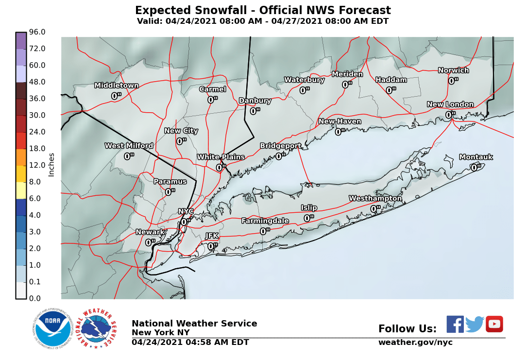
NWS Most likely accumulations

Mayor de Blasio today issued a hazardous travel advisory for Saturday, January 23, 2016 through Sunday, January 24, 2016. Nassau, Suffolk and Westchester Counties have issued similar advisories. The National Weather Service (NWS) has issued a Blizzard Watch for New York City from Saturday morning through Sunday afternoon. This system is forecast to bring heavy snow along with strong and potentially damaging winds, and will create slick and hazardous travel conditions. Stay tuned for the latest updates via Notify NYC, NYC Severe Weather.

What’s in store? For most of the region, the current NWS forecast is for heavy snow (8 to 12 inches forecast) and potentially damaging northeast winds of 25 to 35 mph with gusts up to 50 mph in much of the region. There is also likely to be coastal flooding over multiple high tide cycles.

How should I prepare? Travel during the storm may be extremely dangerous due to heavy snowfall, strong winds and whiteout conditions. Some roads may become impassable and strong winds may down power lines and tree limbs.

  • Stock up with enough food and supplies. You might not be able to shop over the weekend.
  • Have extra batteries on hand in the event of power outages.
  • Check on your neighbors, especially those who are vulnerable.

Travel Safety Tips. New Yorkers are encouraged to take the following precautions:

Motorists

  • If you must drive a vehicle, monitor weather and traffic reports for the latest road conditions. Use mass transportation whenever possible.
  • Drive slowly. Posted speed limits are for ideal weather conditions. Vehicles take longer to stop on snow and ice than on dry pavement.
  • Use major streets or highways for travel whenever possible.
  • Four-wheel drive vehicles may make it easier to drive on snow-covered roads, but they do not stop quicker than other vehicles.
  • Keep the name and phone number of at least one local towing service in your car in case you break down or become stuck in snow.
  • If you get stuck on the road, stay with your car and contact a towing company.

Pedestrians

  • Exercise caution and avoid slippery surfaces; some ice may not be visible.
  • Wear layers including a hat, gloves/mittens, and a scarf to stay protected from the cold. And keep clothes and shoes dry, if a layer becomes wet, remove it.
  • Keep fingertips, earlobes, and noses covered if you go outside.
  • Have heightened awareness of cars, particularly when approaching or crossing intersections.
  • Wear sturdy boots that provide traction to reduce slipping. Use handrails when using stairs.
  • Seniors should take extra care outdoors to avoid slips and falls from icy conditions.

Safe Home Heating Tips

  • Report any loss of heat or hot water to property managers immediately, and call 311.
  • If homes lack heat, get to a warm place, if possible, and wear extra layers of dry, loose-fitting clothing, hats and gloves to help stay warm.
  • Never use a gas stove to heat your home.
  • Never use a kerosene or propane space heater, charcoal or gas grill, or generator indoors or near the home.
  • Check on your neighbors, friends, and relatives — especially the elderly and those with disabilities and access and functional needs. People most likely to be exposed to dangerous winter weather conditions include those who lack shelter, work outdoors, and/or live in homes with malfunctioning or inadequate heat. Seniors, infants, people with chronic cardiovascular or lung conditions, people using alcohol or drugs, and people with cognitive impairments such as from dementia, serious mental illness or developmental disability, are at increased risk.

More Information
For more helpful tips for staying warm and safe, view NYC Emergency Management’s public service video announcement, or visit NYC.gov/EmergencyManagement. New Yorkers are also encouraged to sign up for Notify NYC, the City’s free emergency notification system. Through Notify NYC, New Yorkers can receive phone calls, text messages, and/or emails alerts about traffic and transit disruptions and other emergencies. To sign up for Notify NYC, call 311, visit NYC.gov/notifynyc, or follow @NotifyNYC on Twitter.

Sukkahs in the wind

October 01, 2015

Please distribute on blogs and synagogue/community listserves.

NYC Emergency Management (NYCEM) is now advising New Yorkers to prepare for ongoing sustained winds upwards of 30mph with wind gusts in excess of 70mph. Most Succoth, especially in open areas or experiencing sustained gusts, are not built for such conditions.

The Rabbinical Council of America is distributing this document, developed by Rabbi Kenneth Brander with profound thanks to Rav Hershel Schachter, shlita for his guidance. The relevant portion of the document follows:

Sukkot, Shemeni Atzeret & Simchat HaTorah

  •  If the weather forecast is for winds of over 40 mph there is a serious danger that the sukkah will become flying debris which can create dangerous projectiles and should be dismantled before Shabbat/Yom Tov.
  • If there is a concern of schach flying around (in winds that are less than 40 mph winds) then the schach can be tied down even with plastic cable ties.
  • If schach needs to be replaced or tied down on the sukkah on Shabbat or Yom Tov in can be done by a Gentile.
  • If there is concern about going to shul on Simchat Torah morning – Vezot ha’Berakha can be read on the night of Simchat Torah in five aliyot. Alternatively should the storm pass by Simchat Torah afternoon then hakafot and torah reading can be read at an early mincha on Simchat Torah.

Of course, individuals and organizations should consult with their appropriate halachic authorities. Some additional tips:

  • Secure your Sukkah to fixed objects such as posts or fencing. Unsecured bamboo mats can become airborne, leading to injuries and property damage. Unsecured walls (either canvas or plywood) are essentially sails and could collapse and/or blow away. This is already happening in the Washington, DC area.
  • Balconies. Succoth built on balconies on higher floors are subject to higher winds.
  • There is a likelihood of blackouts during the storm. See the RCA document here for additional guidance. The source document with citations can be found here.
  • Drying. If you do take down and secure your Sukkah over the next few days, the materials and skhakh are likely to be wet. To avoid mold, be sure to thoroughly dry everything after Sukkoth before you store it. (HT Dori Zofan).

Thanks to NYCEM Commissioner Joseph Esposito and Assistant Commissioner Ira Tannenbaum for their ongoing leadership and concern. Here is the NYCEM guidance:

The National Weather Service forecast for the next several days includes wind speeds that are predicted to be between 15 and 30 miles per hour with gusts up to 40 mph at times. High winds can down trees and power lines, blow out windows, blow down signs, cause flying debris, and structural collapse. Individuals who have constructed a Succah for the holiday should take appropriate actions to secure the structure and roofing to prevent damage or injury from flying debris.

Ira Tannenbaum
Assistant Commissioner, Public/Private Initiatives
New York City Emergency Management
165 Cadman Plaza East
Brooklyn, NY 11201

http://www.nhc.noaa.gov/storm_graphics/AT11/refresh/AL1115W5+gif/180011W_sm.gif

New “reduce your risk” tools

November 27, 2014

New York City’s dense population and geographic location make it especially vulnerable to emergencies caused by natural and man-made hazards. While it is important for you to protect yourself and your families from emergencies, it is also important to protect your property. The hazards faced by Nassau, Suffolk and Westchester residents are similar, with some exceptions (e.g., Westchester planners are concerned with an Indian Point event).

The New York City Emergency Management Department, in partnership with the New York City Department of City Planning and the Mayor’s Office of Recovery and Resiliency, is pleased to announce the launch of NYC’s Risk Landscape: A Guide to Hazard Mitigation. Based on the FEMA-approved and locally adopted 2014 Hazard Mitigation Plan, NYC’s Risk Landscape focuses on a targeted group of hazards that pose a risk to the city, and includes information on how the City approaches risk management in a user-friendly and accessible format.  Additionally, the guide includes informative maps, infographics, and images to help New Yorkers gain a deeper understanding of specific hazards as well as best practices in risk reduction.  Hazards addressed in this guide include coastal erosion, coastal storms, earthquakes, extreme heat, flooding, pandemic influenza, strong windstorms, water shortage, and winter weather.

For more information, please visit nyc.gov/hazardmitigation or click here for the guide. Click for specific guidance for Nassau, Suffolk and Westchester Counties and for New York State.

For more information about how to Reduce Your Risk, please visitnyc.gov/reduceyourrisk or click here for the Ready New York: Reduce Your Risk brochure.


Tornado Watch Guidance

September 28, 2010
The National Weather Service has issued a Tornado Watch for most of southern New York State and NJ. Click on the links for more localized information. 
A tornado watch defines an area shaped like a parallelogram, where tornadoes and other kinds of severe weather are possible in the next several hours. It does not mean tornadoes are imminent — just that you need to be alert, and to be prepared to go to safe shelter if tornadoes do happen or a warning is issued.
Recently, New Yorkers have learned that tornadoes can happen here. To learn more about personal preparedness, click here. Jewish organizations should put their tornado watch plans into effect:
  • Flying debris is the greatest hazard in most severe storms. Make sure that your sukkot and their contents are secured or brought inside. 
  • Turn on local TV or radio, turn on and set the alarm switch on your weather radio, make sure you have ready access to safe shelter, and make your friends and family aware of the potential for tornadoes in the area.
  • Keep children at school beyond regular hours if threatening weather is expected; and inform parents of this policy. Children are safer deep within a school than in a bus or car. Students should not be sent home early if severe weather is approaching, because they may still be out on the roads when it hits.
  • Lunches or assemblies in large rooms should be postponed if severe weather is approaching. As illustrated above, gymnasiums, cafeterias, and auditoriums offer no meaningful protection from tornado-strength winds. Also, even if there is no tornado, severe thunderstorms can generate winds strong enough to cause major damage.
  • Get more information tornado preparedness and planning for schools  from the National Weather Service click here.

Prepare for an “active to extremely active” hurricane season

June 15, 2010

Yes, hurricanes can strike the New York area.

An “active to extremely active” hurricane season is expected for the Atlantic Basin this year according to the seasonal outlook issued today by NOAA’s Climate Prediction Center – a division of the National Weather Service. As with every hurricane season, this outlook underscores the importance of having a hurricane preparedness plan in place. Forecasters anticipate the following to affect the Atlantic Basin:

  • 14 to 23 Named Storms (top winds of 39 mph or higher), including:
  • 8 to 14 Hurricanes (top winds of 74 mph or higher), of which:
  • 3 to 7 could be Major Hurricanes (Category 3, 4 or 5; winds of at least 111 mph)

To get more information (including an overview and NY area historic patterns and conditions), view an excellent presentation by I. Ross Dickman, Meteorologist-in-charge, NOAA’s National Weather Service, New York, NY office.

For preparation planning tips, see information from NYC, Nassau (including evacuation routes), Suffolk and Westchester.